
 GOCE – Gravity Field and Steady-State Ocean Circulation Explorer

GOCE succumbed to gravity – the force it had been sent up into space to study. Ironically. When the xenon fuel for this engine was exhausted, the satellite fell back to Earth in November 2013. The first of ESA’s Living Planet Programme satellites, GOCE was intended to map the Earth’s gravity field in unprecedented detail...
To understand how ocean currents move, you need to understand the role of gravity because it is fundamental to being able to track the direction and speed of water across the Earth.
No force on Earth is more familiar than the force of gravity. Whenever we trip, gravity is there waiting for us. The effect of terrestrial gravity on any small body near the surface of the Earth is equivalent to that of a single downward force acting through the centre of mass of the body.
Gravity: Newton’s Proverbial Apple

Newton’s unfortunate misadventure with a fruit may have never happened the way popular science habitually likes to tell it. Nevertheless, the notion of a falling apple is a useful one to keep in mind for our purpose…
Gravity
Again, we ask: “What is gravity?”
A body falling freely near the Earth’s surface, without being impeded by air resistance, accelerates downwards with the acceleration due to gravity of magnitude g. Although the value of g varies slightly from place to place on Earth, it is generally accepted to be about
Newton’s Second Law of Motion states that the magnitude of the force F acting on an object in motion – any object of any size or any mass, including an apple – is related to its mass m and the magnitude of its acceleration a by the equation
 .
.
Predicting the Motion of a Falling Object
The kinetic energy Ek of an object equals its mass m multiplied by its acceleration a multiplied by the distance d travelled by the object. This gives the equation for the kinetic energy:
 .
.“Mr Galileo was correct…”
Gravity g is the same for all bodies at a given location.
Earth’s Gravity in High Definition
Earth’s gravity is subtly influenced by all manner of changes in its structure and topography. Our planet is not a perfect sphere, instead bulging around the equator, making gravity weaker there than at the poles. Gas fields, mineral deposits, aquifers and rock formations also affect the pull of gravity.
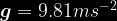
Gravity’s pull varies ever so slightly from place to place because of the uneven distribution of mass inside the planet. At the Earth’s surface, gravity g is an acceleration force equal to about 9.81 metres per second squared. In reality, the figure does vary from a minimum value of 9.78 at the equator to a maximum of 9.83 at the poles.
The GOCE satellite carried instrumentation capable of sensing very subtle changes in Earth’s gravitational tug.
Thus, the basic fact that water always runs downhill has a major influence on the direction and speed of currents – although atmospheric winds and the Earth’s rotation are of course critical partners in the overall picture.
The ‘OC’ in GOCE

GOCE mapped the Earth’s gravitational field by recording its exact position with GPS and detecting variations in the pull of gravity accurate to one part in ten million million.
Scientists have used these observations to construct what is called a “geoid”, which essentially describes the “level surface” on an idealised world. It is the shape the oceans would adopt if there were no winds, no currents and no tides to disturb them.
By comparing this geoid with measurements of sea-surface height made by other satellites, researchers can see where water has become piled up.
Visible in the map are the Agulhas Current flowing down the African coast; the Gulf Stream running across the Atlantic; the Kuroshio Current that sweeps the south of Japan and out into the North Pacific; as well as the Antarctic Circumpolar Current, and the system of currents that hug the Equator.
In places, these great trains of water move in excess of 1 metre per second.
The Gulf Stream
The famous Gulf Stream takes warm water from the tropics and transports it to higher latitudes where that warmth is released to the atmosphere. This ‘conveyor belt’ of the Atlantic Ocean keeps the British Isles much warmer than they would otherwise be without it. When this water reaches even higher latitudes, it is by then cold, salty and dense. The Gulf Stream sinks. This overturning water circulation helps regulate Earth’s climate.
The Gulf Stream is very strongly represented in the new map as the most intense of all the currents where water zips along at velocities greater than one metre per second in places.

The new GOCE model of ocean circulation was checked against the point measurements from drifting buoys. This has helped to capture some of the smaller-scale features in the currents that lie beyond the capabilities of satellites, even one that made as highly resolved observations as the ESA mission.
Geoid Measurement
The mission objective in terms of geoid measurement was achieved at 1-2 centimetre accuracy at 100 km resolution, and in terms of ocean currents this translates into an error that is less than 4 cm/s.
Mapping Gravity with GOCE

The “Ferrari of Space”
GOCE was launched in March 2009. The spacecraft operated from 2009 to 2013, making ultra-precise measurements of Earth’s gravity. To do this, the GOCE satellite flew on a lower orbit than any other scientific satellite.
Nicknamed the “Ferrari of Space” because of its sleek looks and the fact it was assembled in Italy, the satellite’s unique arrow-shaped design and fins helped keep GOCE stable as it cruised through the upper thermosphere at an altitude of 255 kilometres (about 158 miles up), where the gravitational force is stronger near the Earth.
Additionally, an ion propulsion system continuously compensated for the variable deceleration due to air drag without the vibration of a conventional chemically powered rocket engine, thus limiting the errors in gravity gradient measurements caused by non-gravitational forces and restoring the path of the craft as closely as possible to a purely inertial trajectory.

On 21 October 2013, the mission came to a natural end when it ran out of fuel. Three weeks after running out of propellant, the satellite began dropping out of orbit and made an uncontrolled re-entry on 11th November 2013.
The satellite disintegrated in the lower atmosphere and some of its debris reportedly fell into the South Atlantic, just south of the Falkland Islands. Full circle. The ultimate fate of GOCE was to be beaten by the very force of gravity it went up to study in the first place. How ironic…
Although its flight mission is over, the great wealth of data gathered from the GOCE spacecraft continues to be exploited to improve our understanding of ocean circulation, sea level, ice dynamics and Earth’s interior.
Scientists can now add in all the data collected about sea temperature to calculate the amount of energy the oceans move around the Earth. Computer models that try to forecast future climate behaviour have to incorporate such details if they are to run even more realistic simulations.